DATA COLLECTION
Data Acquisition:
- PMC Shapefile from the DataMeet server- open to the general public.
- Emergency Healthcare Facilities: Hospitals and Ambulance Services within the PMC boundary.
Hospital Data was obtained using both OverpassTurbo-A web based data mining tool for OpenStreetMaps, which runs any Overpass API query and depicts the results on an interactive map and Censes Data off the PMC website online.
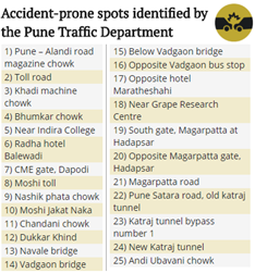
Ambulance Services across PMC region was collected off various online directories and later plotted and registered as a KML layer, using Google Earth Pro. - Accident Hotspots, as suggested by the Pune Traffic Department was obtained from a hindustantimes article, dated July 21, 2017.

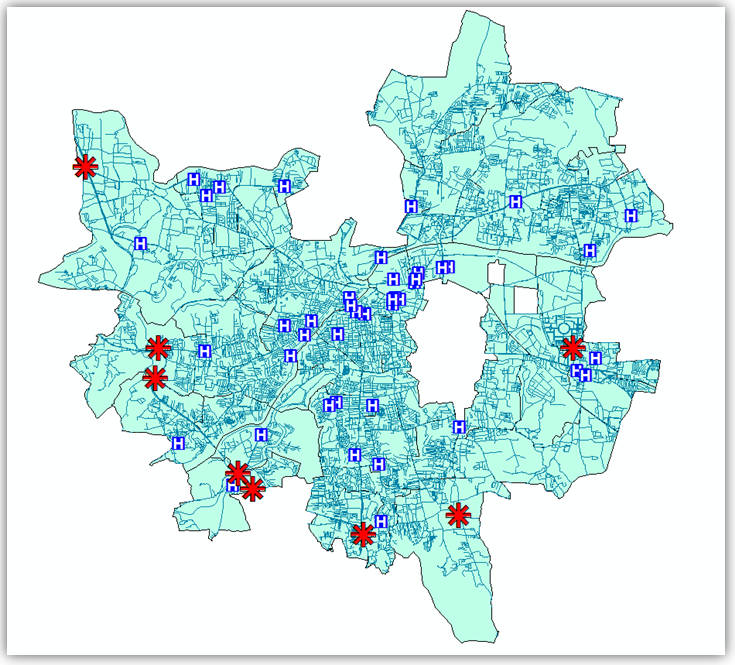
Compiled view of PMC region layer, Hospitals in PMC layers, Road network layer and Accident hotspots layer:-
